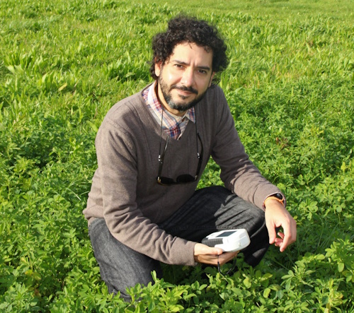
Francelino has been working with precision agriculture and remote sensing since his undergraduate days in Brazil.
What if farmers could use satellite data to pinpoint exactly where fields were suffering from water or nutrient stress – and exactly how much water or nutrients they needed?
If drone imaging could reveal objectively which plants had desirable traits, and so speed up crop breeding programmes?
Or if data from images could reveal the early symptoms and spread of crop diseases?
These possibilities are becoming realities, thanks to the science of remote sensing and its application by multidisciplinary teams across the primary sector. It’s a worldwide growth area, and Lincoln Agritech is growing its capability through Precision Agriculture 2IC Francelino Rodrigues.
Francelino, who joined Lincoln Agritech in July 2021, has been working with precision agriculture and remote sensing since his undergraduate days in Brazil. He was so fascinated by the idea of combining agriculture and technology that he made it the subject of his master’s and doctoral degrees in agricultural engineering.
Before joining Lincoln Agritech, he worked in Mexico at the International Maize and Wheat Improvement Center (CIMMYT). Here, he used remote sensing for high-throughput phenotyping to enhance breeding programmes and to develop decision support systems to help farmers improve crop management.
Remote sensing uses imaging from different parts of the electromagnetic spectrum to “see” features that humans can’t see – or can’t objectively judge very easily. For example, thermal and infrared imaging can help to revel stresses or plant traits that a farmer or horticulturalist needs to know.
“If you look at screening for disease resistance, this can be time-consuming if done manually, and requires very highly trained personnel to minimise subjectiveness,” says Francelino. “The results may be variable, as every person may make a different visual assessment.”
However, imagery can be calibrated to quickly and accurately reveal the desirable traits, taking much of the guesswork and time out of the process.
Remote sensing can be used at every scale, from plot-sized right up to whole watersheds or national scales. The main difference is the scale of the imaging equipment, from drone-mounted at the near scale, to satellite imagery at the regional scale.
“If we are doing remote sensing through satellite imagery, we can reach a much wider spatial scale and, as a consequence, many more users,” says Francelino. “So the key is to make sure that what we are developing using the low-altitude platforms, and what we are measuring, is also measurable through satellite sensors. This is the beauty of upscaling information!”
Francelino is now growing Lincoln Agritech’s capability to carry out remote sensing research on New Zealand farms and landscapes, to discover solutions for our country’s agricultural and environmental issues.